

Athmo
-
Gesamte Inhalte
7 -
Benutzer seit
-
Letzter Besuch
Nie
Alle erstellten Inhalte von Athmo
-
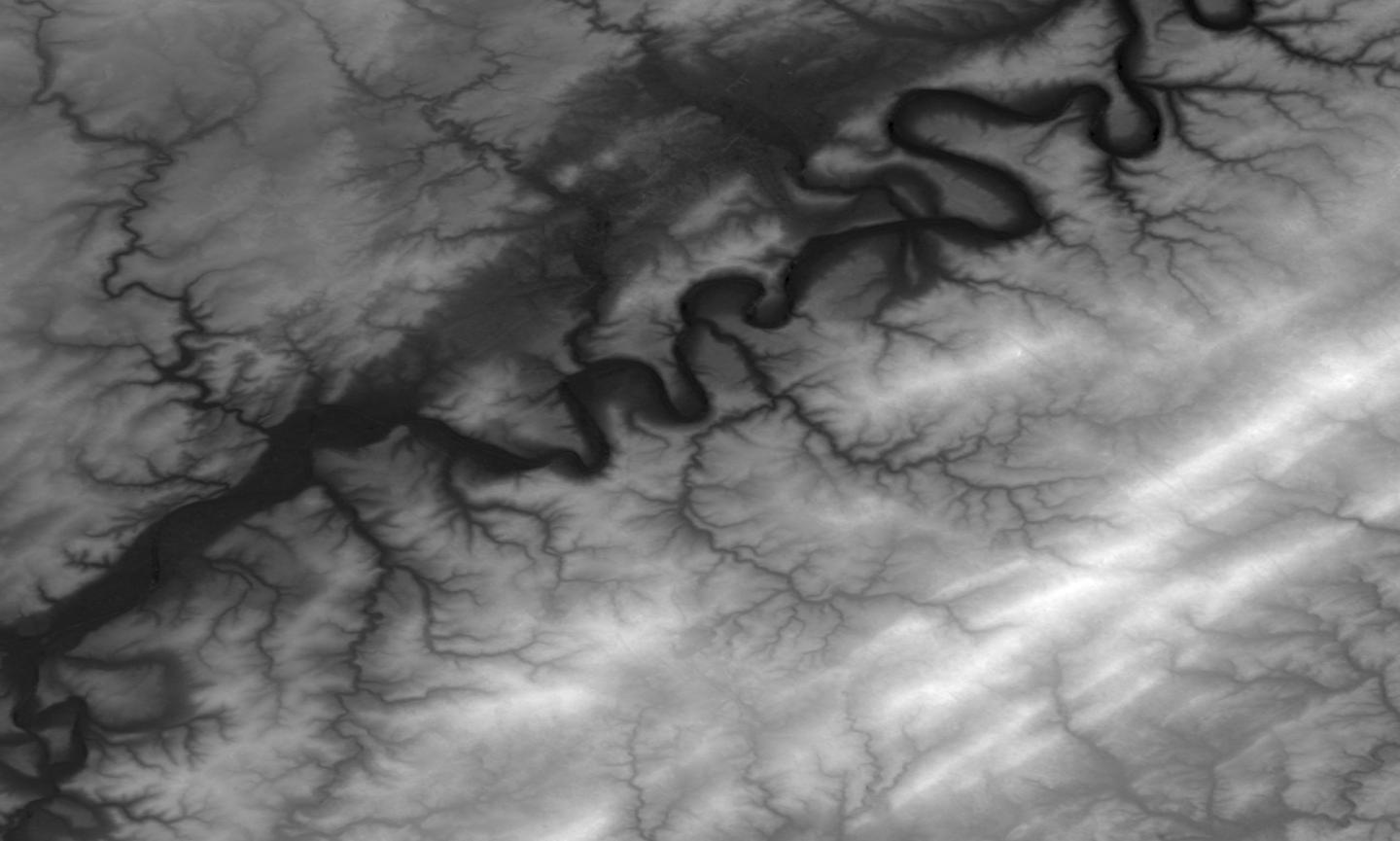
Hi Bahnland, Translating is not required, Google handles that for us :-) The problem you are showing has to do with the low resolution sample images. When you create an account at Nasa you can select exactly what you need and download the heightmap in much higher detail, resolution and grayscale definition. If you have to you can then upscale and filter the image using Photoshop and such to enhance it. For example upscale the image and use interpolation or gausian blur filters on it. Have fun! Athmo
-
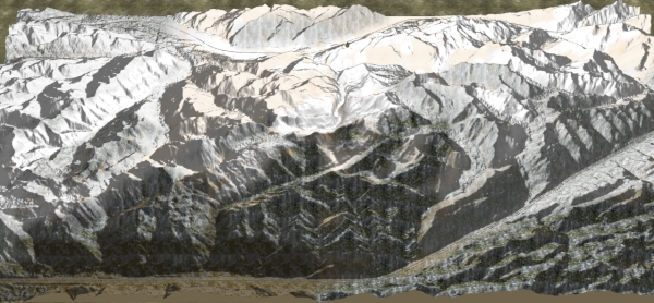
Quick experiment with the Interlaken map. It's almost Christmas anyway. Athmo

-
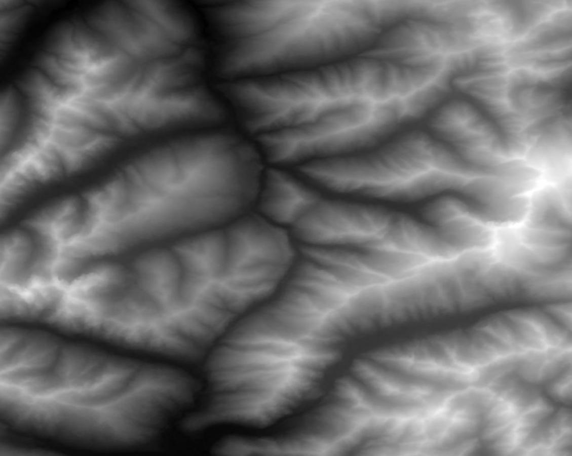
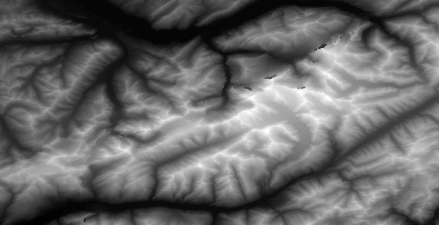
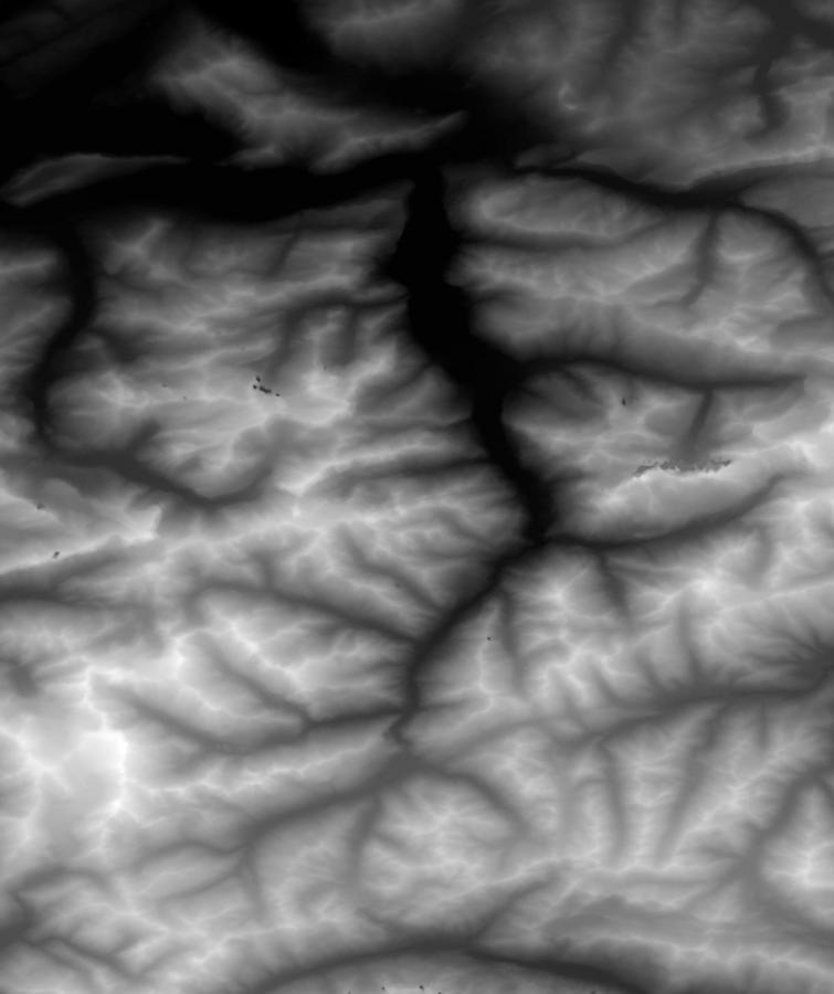
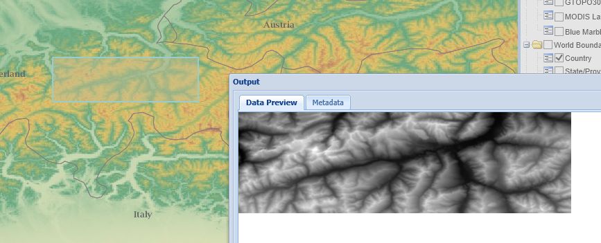
Here are some maps that may be useful. You have to cut/resize them depening on your board size. Brenner pass Interlaken Gotthard Heidelberg (if i'm not lost, the NASA maps don't show city names so I have to compare with Google maps) If you need higher resolution just PM me, the forum resized them. If more people are interested maybe it's good to add a height maps category in the program, like the other materials. Enjoy, Athmo
-
@Brummi, that's look very useful! Where did you take your heightmap from? Athmo
-
All, I did some further searching and like to share my findings.To create landscape by hand, World machine seems the best choice. It can generate landscape, but you can draw by hand too. On youtube you'll find tutorials but it is a lot of work. Results look very good. If you're looking for real life landscape, I think I found the easiest way there is.We can use NASA Global Data Explorer for free, it will give a heightmap in two clicks.http://gdex.cr.usgs.gov/gdex/You just have to register your email before you can download. Select your area on the map, click the download button, select jpg and download the heightmap image. Now how cool is that? Athmo
-
Hi Bahnland, I think the 'easiest' way to get a proper height map is using digital elevation data, and some converter tool to convert the DEM to heightmap. This is a list of DEM sources: http://udn.epicgames.com/Three/TerrainsFromDEMs.html and Earth explorer offers data from many satellites. http://earthexplorer.usgs.gov/ Another way to go may be this tool. Its for Unity but is a standalone heightmap exporter from DEM:http://forum.unity3d.com/threads/worldcomposer-a-tool-to-create-real-world-aaa-quality-terrain.215485/ For building your terrain by hand, this is a huge list of tools http://vterrain.org/Packages/Artificial/ ... but real easy, no. Hope that helps! Athmo
-
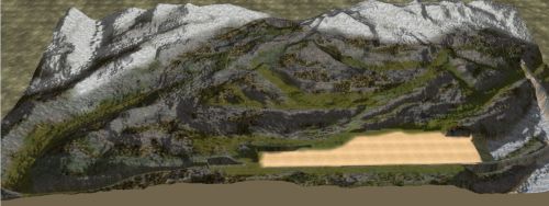
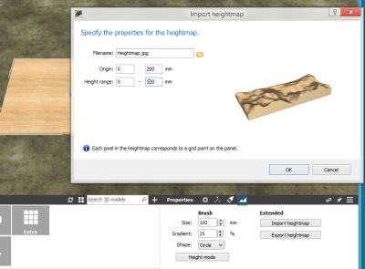
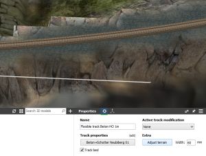
Hi all, Good to hear that you like them! Sorry - I'm not from Germany and have to reply in English. If you have urgent questions just send me a personal message. The mountains I uploaded are my first experiments, to see if it is possible to do what I always wanted to build since i was a boy but in real life can never do. And now with this program we can.To build realistic mountains I wanted:- LARGE (in my case 15x30 meters, it does not have to fit in my room anymore)- Natural scenery- Flex rails to have real-life cornersI uploaded my current work in progress (Mountain track 02V01) witch I painted and made a single track running to see what the results and issues would be. There are some issues i'm sure can be worked out, but overall the result is impressive for just a few hours clicking. And it's not that difficult to do. I will tell you the short version here, I can make a visual step by step guide if people want it. This is what I did, it may not be 100% correct so comment if you have better solutions: - Go to Google and search for heightmap images.They are black and white, white = high, black = low.If you have plenty of time you can make your own in special landscape tools. I did not. Take a few images and save them to disk. Convert them to jpg. - Start a new train project, select a blank board.- Doubleclick the board and click the landscape properties icon on the lower right.- Click import heightmap- select your file- click OK You have to play around with the origin (default height) and maximum height and even have to resize your heightmap image, but that's about it. Beware that ANY objects you add to your scene are added at 0 level. So they will by befault be buried in your mountain.A thing I did was move the whole mountain to -1000, so that new stuff is visible.Now you can spray paint your mountains and add tracks. Adding much trees and bushes eat up your cpu/gpu so use them carefully.One issue I have is that the resolution of the 'Adjust Terrain' button is very low now. I assume that has to do with the scale of my platform.Now the round track has blocky mountains. I tried to change the height resolution afterwards, but then everything is one blocky mosaic.Have fun! Athmo